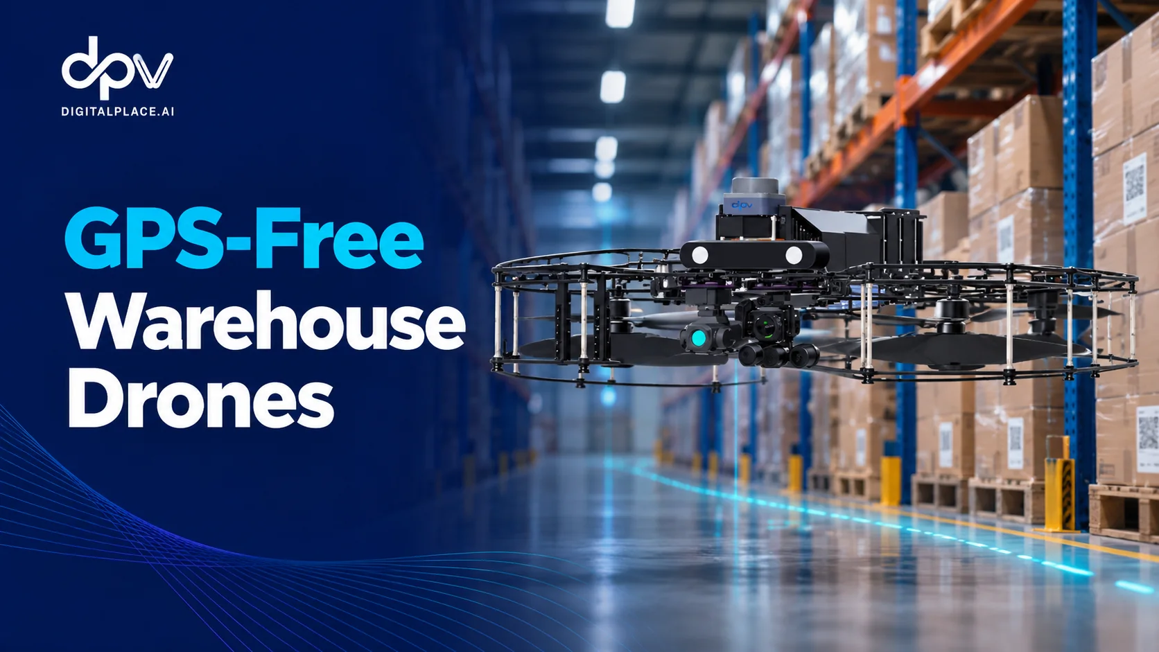
Key takeaway: Warehouse inventory drones can navigate indoor storage environments without GPS or newly installed Wi-Fi infrastructure by relying on onboard navigation capabilities and predefined flight missions. For Singapore warehouse operators, the important distinction is that autonomous navigation, wireless communication, and inventory data integration are separate functions with different technical requirements.
A GPS-free warehouse drone does not necessarily require a major infrastructure upgrade. However, reliable autonomous operation still depends on suitable warehouse layouts, accurate mission configuration, obstacle management, and consistent inventory identification. Understanding these requirements helps logistics companies distinguish between genuinely autonomous systems and solutions that depend heavily on external positioning infrastructure.
Read more
Warehouse inventory drone solutions
This distinction matters for Singapore warehouses, where high-density storage, multi-level pallet racks, and recurring inventory checks create opportunities for automation. The objective is not simply to make a drone fly indoors, but to enable repeatable inventory verification while minimising disruption to normal warehouse operations.
Why GPS Cannot Be Relied Upon Inside Warehouses
Global Positioning System (GPS) technology uses signals transmitted by satellites to estimate a receiver’s geographic position. Although GPS is widely used for outdoor navigation, these signals become unreliable or unavailable inside large buildings, particularly warehouses with reinforced structures, metal roofs, and dense storage racks.
Even when some satellite signals penetrate a building, the positioning accuracy may not be sufficient for autonomous drone operations. A warehouse drone must maintain safe clearance from racks and obstacles while positioning its scanning equipment close enough to identify inventory labels.
For example, a warehouse may contain several aisles with nearly identical rack configurations. Each aisle could have multiple vertical levels and hundreds of pallet locations. The drone needs to distinguish between these locations accurately, even though their physical appearance may be similar.
This creates a different navigation problem from outdoor flight. Rather than relying on geographic coordinates, an indoor drone must establish its position relative to the warehouse environment and its configured route.
A 2025 research review published in Satellite Navigation examines GPS-denied UAV navigation methods, including sensor fusion and alternative localisation approaches. The research highlights the importance of reliable positioning methods when satellite-based navigation is unavailable.
How GPS-Free Warehouse Drone Navigation Works
GPS-free navigation does not refer to a single technology. Different autonomous drone systems may combine onboard sensors, localisation algorithms, environmental measurements, and predefined navigation routes to estimate their position and maintain stable flight.
Onboard Localisation and Environmental Sensing
Indoor drones can use several approaches to estimate their position and movement. Depending on the system architecture, these may involve cameras, inertial measurement units, LiDAR sensors, visual-inertial odometry, or simultaneous localisation and mapping (SLAM).
Inertial sensors measure movement and rotation, while cameras or other environmental sensors can provide additional information about surrounding structures. Combining these measurements helps autonomous systems estimate position when GPS is unavailable.
However, not every warehouse drone uses the same combination of technologies. Some approaches rely primarily on onboard sensing, while others require external markers, positioning anchors, or additional infrastructure.
A 2025 study published in Drones, titled Collaborative Infrastructure-Free Aerial–Ground Robotic System for Warehouse Inventory Data Capture, demonstrates an alternative approach to warehouse inventory data collection without external positioning infrastructure. Its experimental architecture combines aerial and ground robots, illustrating how GPS-denied navigation can be achieved through specialised localisation and control methods.
These findings demonstrate the broader technological direction of indoor warehouse robotics, rather than describing the specific internal navigation architecture of any commercial drone.

How GPS-Free Warehouse
Drone Navigation Works
Indoor inventory drones can navigate configured warehouse routes without GPS or newly installed Wi-Fi infrastructure. Understanding how navigation, communication, and inventory data processing differ is essential when evaluating autonomous warehouse technology.
GPS-free navigation means the drone does not depend on satellite positioning to follow its indoor flight mission. It does not mean that communication, mission management, or inventory data transfer are unnecessary.
Three Different Systems, Three Different Jobs
Autonomous warehouse inventory verification involves more than flying a drone. These three functional layers serve different purposes and should be evaluated separately.
Autonomous Navigation
The drone estimates its position, follows configured indoor flight routes, and uses onboard capabilities to support movement through warehouse aisles.
GPS NOT REQUIREDCommunication & Configuration
Mission management supports route configuration, operational monitoring, and other communication functions. These are separate from the drone’s positioning system.
NO NEW WI-FI INFRASTRUCTURE*Scanning & Inventory Data
Captured QR or barcode information is associated with warehouse locations. Results can be reviewed, reported, or connected to existing warehouse management systems.
WMS CONNECTION OPTIONALA warehouse drone may navigate using onboard capabilities without GPS or continuous Wi-Fi-based positioning. Communication may still be used for mission management, result retrieval, or WMS integration.
From Warehouse Setup to Repeatable Inventory Scans
A structured scanning workflow allows configured warehouse zones to be checked repeatedly without manually piloting every inventory mission.
Measure
Assess aisle dimensions, rack geometry, flight clearance, and scanning requirements.
Configure
Set up predefined flight missions for selected warehouse aisles and rack zones.
Scan
Run autonomous missions to capture pallet QR codes or barcodes at configured locations.
Review & Verify
Review scan evidence, identify discrepancies, and connect results to WMS where appropriate.
What Makes a Warehouse Suitable for Drone Navigation?
Reliable autonomous scanning depends on both drone capabilities and warehouse conditions. The following are indicative criteria from Digitalplace.ai’s current deployment guidance.
Predefined Flight Paths and Warehouse Configuration
Autonomous navigation becomes more practical when the warehouse environment is sufficiently structured.
Warehouse aisles, rack dimensions, storage levels, and designated scanning positions provide a predictable framework for configuring flight missions. Rather than allowing a drone to explore the entire facility without constraints, an inventory scanning system can follow predefined routes through selected warehouse zones.
Digitalplace.ai’s warehouse inventory drone uses configured indoor flight missions adapted to the warehouse’s aisle layout and rack dimensions.
This approach allows recurring inventory checks to follow consistent scanning routes. Once the initial warehouse measurements and mission configurations are established, operators can repeat scanning activities without manually piloting the drone through every pallet location.
The objective is repeatability: collecting inventory information from the appropriate locations during scheduled verification missions.
Handling Obstacles and Changing Warehouse Conditions
A predefined route does not mean the warehouse remains completely static.
Pallets may protrude from racks, forklifts may operate nearby, and temporary obstacles may appear in aisles. Autonomous systems therefore need appropriate obstacle sensing and operational safeguards, even when following previously configured flight paths.
Research published in Drones in 2026 identifies collision risks, changing warehouse conditions, and localisation difficulties as important challenges for autonomous warehouse operations.
For practical deployments, this means warehouse operators should evaluate how a drone responds when its configured route becomes obstructed. A system’s behaviour during unexpected conditions can be just as important as its performance during an uninterrupted demonstration.
Does GPS-Free Navigation Mean a Warehouse Drone Does Not Need Wi-Fi?
One of the most important technical distinctions in warehouse drone automation is the difference between navigation and communication.
GPS provides positioning information, whereas Wi-Fi primarily enables communication between connected devices and systems. Neither performs the same function as an onboard flight controller or an inventory scanning application.
A drone may therefore navigate autonomously without depending on a continuous warehouse Wi-Fi connection. However, this does not necessarily mean that the entire inventory verification process operates without connectivity.
Three functions should be considered separately:
- Autonomous navigation: Determines how the drone follows its configured route, estimates its position, and manages flight.
- Mission communication: Supports functions such as mission configuration, status monitoring, and operational control, depending on the system.
- Inventory data integration: Enables scanning results to be reviewed, transferred, or connected to warehouse management systems.
The distinction has practical implications for Singapore warehouses. Installing additional access points or positioning infrastructure can create deployment costs, especially in facilities with extensive pallet racking or inconsistent wireless coverage.
However, claims about operating without new Wi-Fi infrastructure should not be interpreted as proof that no communication or network access is needed at any stage. Operators must understand how missions are configured, how results are retrieved, and what happens when communication becomes unavailable.
From Warehouse Measurements to Repeatable Autonomous Missions
One advantage of structured indoor navigation is that warehouse operators do not necessarily need to redesign their facilities around autonomous drones.
For the warehouse inventory drone from Digitalplace.ai, standard deployment involves measuring the warehouse’s aisle and rack dimensions, configuring flight missions, and establishing the scanning process. The drone can then carry out predefined inventory checks, with results available for review, reporting, or connection to the warehouse management system (WMS). This approach is designed to support recurring pallet-level verification without requiring GPS or newly installed warehouse Wi-Fi infrastructure for standard operation.
The operational workflow can be understood through four stages.
1. Warehouse measurement and assessment
The facility’s aisle dimensions, rack heights, scanning requirements, and potential flight obstructions are evaluated before mission configuration.
2. Flight mission configuration
Selected aisles and rack zones are translated into predefined scanning missions. Flight paths and scanning positions are adapted to the warehouse layout.
3. Autonomous inventory scanning
The drone follows the configured mission and captures QR code or barcode information from designated pallet locations.
4. Inventory results and verification
Captured information becomes available for review and comparison with inventory records. Where appropriate, results can be connected to the existing WMS.
This process creates an important separation between physical inventory data collection and inventory record management. A successful drone scan provides evidence about a pallet or location, but discrepancies may still require investigation before warehouse records are corrected.
What Warehouse Conditions Are Required for Reliable GPS-Free Navigation?
A drone’s ability to navigate without GPS does not remove physical or environmental constraints.
Warehouse geometry, storage practices, airflow, and label placement all influence whether autonomous inventory scanning can operate consistently.
According to Digitalplace.ai’s current deployment guidance, its standard warehouse application is designed around structured pallet storage environments. Relevant assessment criteria include clear flight paths, adequate aisle width, suitable rack dimensions, and consistent pallet identification labels. The documented operating environment covers temperatures between 10°C and 45°C, while frozen storage and extremely dusty facilities fall outside the currently recommended conditions.
These are product-specific deployment considerations rather than universal specifications for all warehouse drones.
Other factors also deserve attention. Loose stretch wrap, protruding pallets, overhead structures, and strong ventilation airflow can introduce operational challenges. Scanning reliability may also be affected by damaged labels, inconsistent QR positioning, glare, or partially obstructed identification codes.
For warehouse managers, this reinforces an important principle: successful autonomous navigation depends on both the technology and the environment in which it operates.
What Does GPS-Free Warehouse Automation Mean for Singapore?
Singapore’s logistics industry continues to prioritise digital transformation and productivity improvements. The Infocomm Media Development Authority (IMDA), together with Enterprise Singapore and industry partners, has refreshed the Logistics Industry Digital Plan to help logistics companies assess digital solutions and develop workforce capabilities.
For warehouse operators in Tuas, Jurong, and Changi, GPS-free inventory drones offer a potential way to introduce more frequent inventory verification without rebuilding existing warehouse positioning infrastructure. Their suitability depends on the facility’s rack configuration, operating conditions, scanning requirements, and readiness for autonomous operations.
Regulatory and workplace safety considerations remain relevant. The Civil Aviation Authority of Singapore (CAAS) distinguishes indoor and outdoor unmanned aircraft operations, with requirements depending on factors including aircraft registration, operating purpose, and whether an indoor location is publicly accessible. Warehouse operators should review the applicable rules rather than assuming all autonomous indoor operations are exempt from regulatory requirements.
Equally important is operational safety. Drone missions should be assessed alongside forklift movements, personnel access, emergency procedures, and potential interruptions to normal warehouse activity.
Beyond GPS-Free Flight: What Should Warehouse Operators Evaluate?
The absence of GPS or new Wi-Fi requirements can simplify aspects of deployment, but it should not be the only factor influencing a technology decision.
Warehouse managers should evaluate whether the system can consistently navigate configured routes, cover the intended pallet locations, and generate usable inventory evidence. They should also understand how the drone handles incomplete scans, changes in warehouse layout, and interrupted missions.
Digitalplace.ai’s warehouse inventory drone is designed to make pallet-level inventory verification a repeatable warehouse operation rather than an occasional manual counting exercise.
The longer-term value of GPS-free warehouse drone technology lies in connecting reliable autonomous movement with dependable inventory information. For Singapore logistics companies, the central question is therefore not simply whether a drone can fly without GPS, but whether it can repeatedly verify the right warehouse locations, produce useful inventory evidence, and fit safely into existing operations.
When those conditions are met, autonomous scanning can become a practical component of more consistent, data-driven warehouse inventory management.